
Preparing Delaware communities and local businesses to bounce back from natural coastal hazards. Delaware's coastal economy contributes around $7 billion to the state annually. But coastal hazards such as hurricanes and severe storms, beach erosion, flooding, and sea level rise pose a threat to that economic contribution. Delaware Sea Grant is funding research that identifies critical areas for infrastructure development and community preparedness that will enable coastal communities and local businesses to be resilient in the face of destructive natural processes.
Current research projects
-
Investigators: Christina McGranaghan, Laura Paul, Kent Messer, Leah H. Palm-Forster, A.R. Siders
As the lowest-lying state in the nation, Delaware is susceptible to sea level rise and extreme weather events. State agencies and communities must adapt to changing conditions using approaches such as property elevations, beach nourishment, living shorelines, and voluntary home buyout programs. Voluntary home buyouts can be an effective way to protect homeowners physically and financially from severe and repeated flood risk, while also benefiting the surrounding community. Purchased lots can be converted into wetlands that reduce flood pressure on neighboring properties, and publicly owned infrastructures can be removed if it is no longer used.
However, the degree to which these benefits are realized depends on the spatial arrangement of properties acquired. Large contiguous areas provide greater wetland value, are cheaper to sustain, and are more likely to reduce the need to maintain vulnerable infrastructures than areas featuring a patchwork of successful buyouts. The spatial arrangement also matters to homeowners whose valuations of their properties depend, in part, on whether current neighbors stay or move away. Delaware’s current acquisition mechanisms are not as cost-effective as possible because spatial dimensions are not considered.
This project draws on the economics literature addressing spatial dependencies in land conservation to identify alternative acquisition mechanisms that explicitly encourage spatial coordination. To test the cost-effectiveness of these mechanisms for home buyouts, the project proposes an experimental economics framework that captures relevant dimensions of buyout projects. This experimental platform will provide an important pre-disaster communication tool to highlight the benefits of spatially coordinated approaches and promote resilient coastal communities.
-
Investigators: Victor W. Perez, Jennifer A. Horney, Martin D. Heintzelman
Research has demonstrated wetlands and other environmental amenities provide social, economic, and health benefits to surrounding communities. However, these amenities may exacerbate inequities when located in neighborhoods with a history of environmental injustice.
Research in Southbridge, a historically Black community near the South Wilmington Wetland Park, suggests residents have mixed views due to concerns about flooding, exposure to environmental contaminants, and potential for displacement due to green gentrification. The objectives of this interdisciplinary research are to: 1) assess residents' perceptions of potential effects of the Wetland Park, including enhanced social cohesion, flood reduction, property value and housing cost changes, economic growth through green jobs, and positive health impacts; and 2) communicate findings to communities and stakeholders to support positive outcomes for residents in the future.
To accomplish these goals, Photovoice, interviews, surveys, and document reviews will be conducted to collect resident perceptions about expected social, economic, and health
changes resulting from the Wetland Park. Existing local data on property values, flood insurance rates, and other economic indicators will be used to assess whether local perceptions are reflected in these other available data. Existing local data on the prevalence of chronic diseases, healthy lifestyles, and community safety will be used to assess alignment of resident perceptions. Benefits of this project include establishing a baseline measure of community perceptions of benefits of the Wetland Park and documentation of potential threats. Findings will inform the City of Wilmington’s 2028 Comprehensive Plan by promoting the role of equity in neighborhood revitalization and redevelopment planning.
Ongoing and past projects
-
Investigators: Dr. Arthur C. Trembanis and Ashley Norton
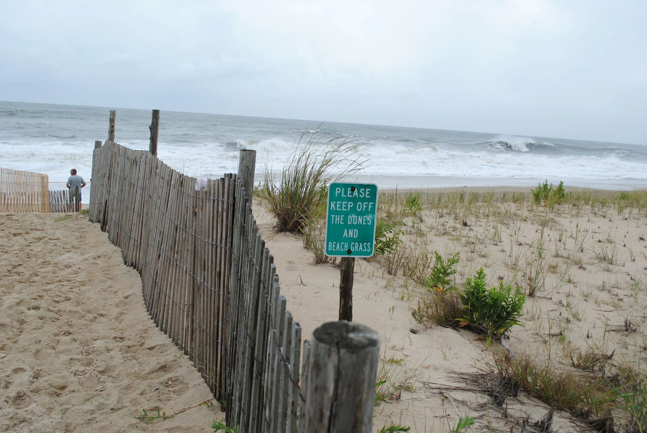
Shoreline change monitoring is critical for safe and effective coastal management, particularly before and after a coastal storm. However, scientists and coastal managers are limited in their capacity to document shoreline change and therefore lack important temporal and spatial sampling. This Delaware CoastSnap proposal aims to leverage smartphone technology, installing cradles that position photographs taken by citizen scientists for repeatability allowing the science team to quantitatively measure shoreline position and beachface slope.
The proposed project will establish three CoastSnap sites on the Delaware Coast, including 2 on the Atlantic Ocean (Herring Point and Indian River Inlet) and 1 on the Delaware Bay (Broadkill Beach). These sites were chosen in collaboration with the Delaware Department of Natural Resources and Environmental Control (DNREC) to align with their management issues and to provide a mix of coastal setting and morphodynamics (i.e. bay beach vs open ocean). -
Investigators: Jack A. Puleo, Jules Bruck, and Fengyan Shi
This study seeks to quantify the relative importance of ship wake versus background wind wave energy affecting tidal wetlands in the Delaware estuary, develop and test a low-cost living shoreline that can withstand ship wake energy, and design and test methods to enhance the public’s environmental literacy about the value of living shorelines.
Results will be achieved through extensive field efforts pre- and post-installation of the living shoreline; through collaboration with a technical review panel consisting of experts from state, local, and non-profit organizations, and professional engineers; and through the calibration/validation of a numerical model for optimal living shoreline design and subsequent predictions of ship wake energy on the installation and DE estuary wetlands. Study impacts include a detailed investigation of the hydrodynamics and dissipation characteristics (rarely undertaken) that will assist in future living shoreline installations, forging ongoing relationships with stakeholders undertaking living shoreline installations, creating a site assessment tool through the numerical model that will be made user-friendly via a graphic user interface, and improving public perception of living shorelines.
-
Investigators: Christopher M. Heckscher, Ph.D., Sonja H. Kolstoe, Ph.D., Murali Temburni, Ph.D., Natasha Whetzel
The coastal woodlands, marsh hummocks, and barrier islands of the Delaware Bay have been identified as potential migratory songbird stopover habitats of global conservation concern, but are threatened by sea-level rise and periodic storm surge. The bayshore draws birdwatchers from around the world during both spring and fall migration, and thus any changes to birding sites might result in negative economic impacts to local economies.
Using seven separate indices, this project will quantify the importance of near-shore habitats to spring and fall transient songbirds thereby applying a conservation value to these systems. The project will identify unprotected habitats to assess the current and future threats posed by climate change and urbanization. Results will provide inputs for a travel cost model which will allow us to conduct an economic welfare analysis of 15 different recreational sites visited by birdwatchers along the Delaware Bay and Delaware coastline. -
Investigators: Drs. James Kirby and Fengyan Shi
Resource managers often rely on computer simulation models to predict the response of ecosystems such as marshes to changing conditions. These models are able to simulate the flow of water from Delaware Bay, through tributaries and creeks, and over the surface of coastal marshes. However, the models are complex and sometimes require days to run a full simulation.
A recently developed modeling method produces open water models that are more precise and require significantly less computing power. Drs. James Kirby and Fengyan Shi will apply this technique – known as subgridding because calculations are generated over smaller areas of coverage than in traditional models – to models of Delaware’s marshes with support from Delaware Sea Grant. The research will ultimately be used inform management decisions in Delaware’s coastal marshes.